Day Hiking in the Badger State
Hiking with Jim Joque –
The number of Badgers fans supporting University of Wisconsin-Madison sports teams is not the reason why Wisconsin is known as the “Badger State.” Nor is it because of the number of badgers (the animal) that exist within the state.
However, Wisconsin history tells us that during the lead mining days of the 1800s, Wisconsin miners dug caves into hillsides like badgers and lived in them during the winter to keep warm. Thus the badger nickname for Wisconsinites was born … and the rest is history. The badger became Wisconsin’s state animal in 1957.
Wisconsin also became the “Dairy State” because of its vast production of dairy goods, including milk, butter and cheese. This takes us to Wisconsin additionally being referred to as the “Cheese State.” Why do you think they call us “Cheeseheads?”

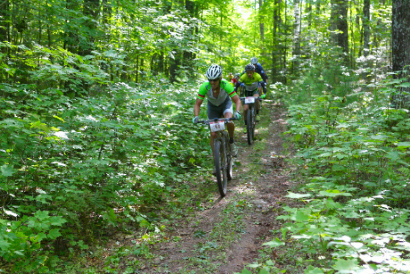
For 18 miles, northern Wisconsin’s Bearskin Trail is a firmly-packed, three-season (spring, summer, fall) scenic byway for hikers and bikers. Kelly O’Day photo
So, Wisconsin has lots of Badgers fans, several badgers in our forests, plenty of dairy products and mucho cheese. But Wisconsin also has many fabulous hiking trails.
Where are these hiking trails?
There are 42 designated Wisconsin State Trails for multiuse purposes. Specifically for hiking, Wisconsin state parks, forests, recreation areas, and wildlife areas are blessed with more than 2,730 miles of hiking trails, according to the Wisconsin DNR state park system. I counted 97 trails on their trails list found at http://dnr.wi.gov/topic/parks/activities/hike.html. In addition to state properties, there is an abundance of walking and hiking trails in Wisconsin county parks and forests, as well as in many parks located within towns and cities across the state.
Wisconsin’s Ice Age National Scenic Trail has about 600 miles completed of the nearly 1,200 designated miles of trails. Connecting routes link the unfinished segments. This magnificent trail system follows the path of ancient ice age glacial activity and runs through 31 counties from the Door Peninsula to the Saint Croix River near Minnesota’s boarder. It passes through public parks, government forests and private lands. On occasion the trail takes hikers into villages, towns and cities. The IAT Alliance states on their website that “this is by design – the Ice Age Trail is meant to connect people and communities.”
Further north in the Badger State is a 200-mile stretch of the North Country National Scenic Trail. The NCT as it is abbreviated is a 4,000-plus mile-long national trail that crosses through seven states from North Dakota to New York. From Minnesota, it intersects the northwest corner of Wisconsin and passes through four Wisconsin counties before heading into the Upper Peninsula near Hurley.
A 61-mile section of the NCT runs through the Chequamegon-Nicolet National Forest. The U.S. Forest Service reports having over 800 miles of day hiking trails to choose from within the five districts of this massive northwoods national forest.
Another national landmark in Wisconsin with unique hiking trail options is found on Lake Superior in the Apostle Islands National Lakeshore. In addition to miles of sandy beaches, there are over 50 miles of maintained trails on its 21 islands, providing access to campsites, historic logging camps, abandoned quarries, lighthouses and scenic overlooks, according to the National Parks Service. And on the mainland, the 4 ½-mile Lakeshore Trail passes along cliffs above the popular sea caves.
Preparations for the day hiker
“Plan ahead and prepare” is a Leave-No-Trace concept, and “be prepared” is a motto I remember from my Boy Scout days. Although a day hike may seem safe and insignificant compared to backpacking and camping, it remains important to plan out your hike and be prepared in the event of an emergency.
First, research some references such as books on hiking – more specifically hiking in Wisconsin. One of my favorites is Eric Hansen’s “Hiking Wisconsin.” Go online to search relevant websites such as WI-DNR State Parks, Ice Age Trail Alliance and more. Then look for specific trail information and trail conditions. Also, go to the National Weather Service (www.weather.gov ) and check weather conditions for the day. Decide where to hike, reference a map to identify trails and trailheads, and then plan out your trip. Decide on a specific distance and timeline for your day hike.
Take along a day pack filled with comfort and safety items. Pack your rain gear, an extra pair of socks should they get wet, map, compass and/or a GPS, cell phone, first aid kit, toilet paper and hand sanitizer, knife and/or multi-tool like a Leatherman , whistle, matches and an emergency mylar blanket that holds 80%-90% of your body heat. Also bring a filled water bottle or two, a sack lunch and/or snacks for nourishment on the trail. Practice Leave-No-Trace by packing out your packaging.
One last suggestion is to go hiking with a friend or family member. You are safer in numbers. But whether with someone or alone, be sure to leave information with somebody back home and let them know where you are going and for how long you plan to be away.
A few memorable trails
I hiked on many Wisconsin trails over the years. Here are a few locations with trails I enjoyed visiting and left fond memories.
North (west to east)
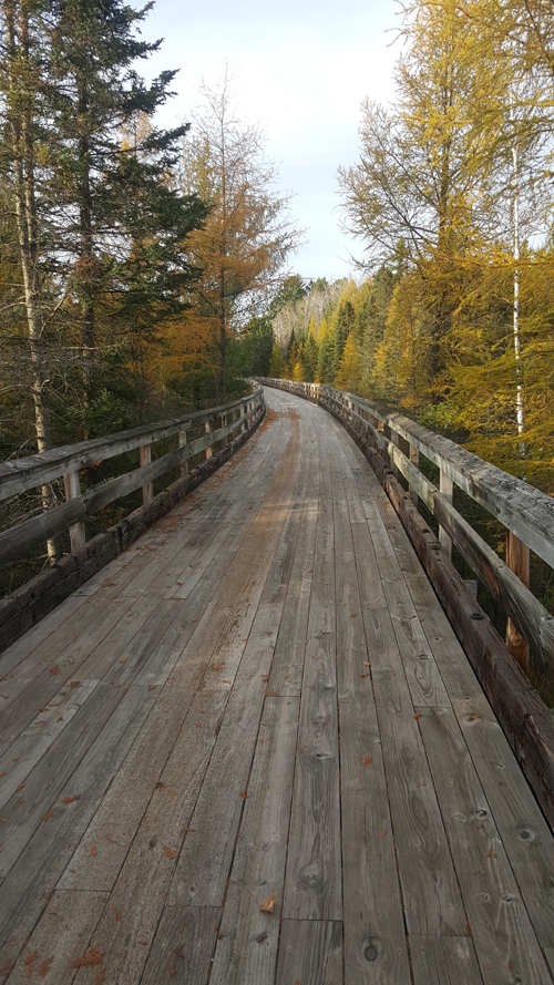
Madeline Island’s Big Bay State Park – Located among the Apostle Islands is Madeline Island with this picturesque park having a 1½ mile sand beach and 7 miles of hiking and nature trails. Unique to the park is a mile-long wooden boardwalk that runs parallel to the Lake Superior beach and through a pine forest. Cross the Rustic Bridge at Big Bay Lagoon or continue on the Lagoon Ridge Trail loop for a lengthy hike.

A beautiful sunset along the Bearskin Trail. Kelly O’Day photo
Bearskin State Trail – Although 18 miles of this 26½-mile northwoods trail is a former railroad bed and used by bicyclers, it is also used by hikers. The trail follows along the Bearskin Creek for a while and then through a scenic forest. A nice starting point is at the trailhead in downtown Minoqua where the trail crosses a wood planked foot-bridge over a segment of Minoqua Lake and then heads south.
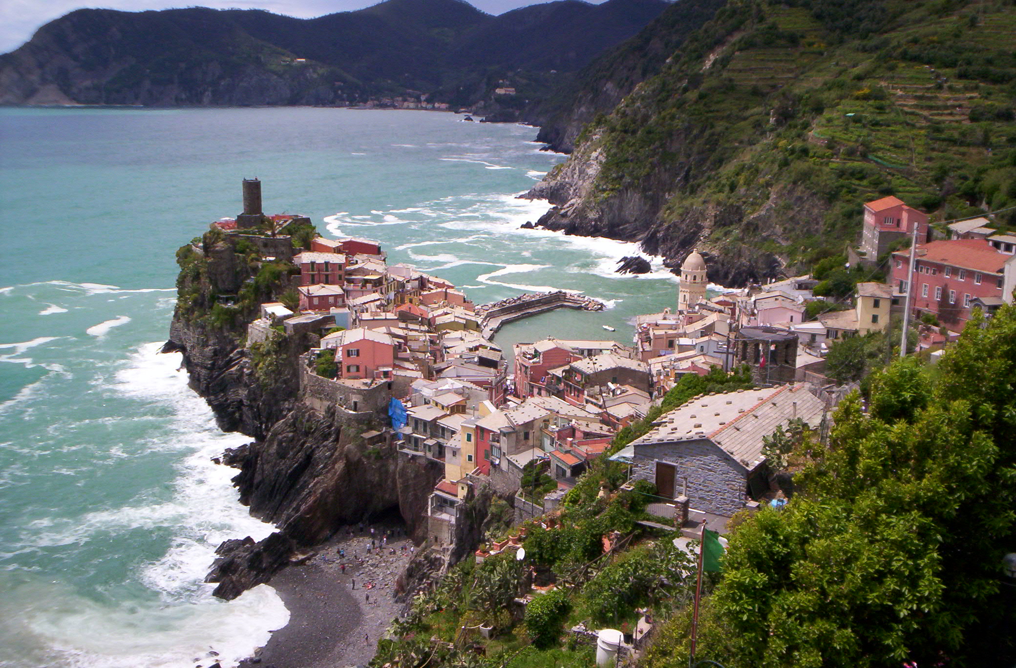
Rock Island State Park – After taking a car ferry to Washington Island off the Door Peninsula, the next step is to take a passenger-only ferry to northernmost Rock Island. Once on this small 912-acre landmass in Lake Michigan, hike its circumference on the 5.2-mile Thordarson Loop Trail. Lakeshore, woodlands, meadows, rock cliffs and Wisconsin’s oldest lighthouse – the Potawatomi Lighthouse – are sights to see along this charming trail.

Author Jim Joque stands in front of the Potawatomi Lighthouse on Rock Island during a past visit.
Central
Hixon Forest – With almost 10 miles of hiking and multi-use trails in this 800-acre city park that sits within and upon the eastern bluffs of La Crosse, your hike culminates at the top of a bluff for exceptional views of the river city and river valley below. In this coulee region of Wisconsin, some of the finest trails are right in La Crosse. The River-to-Bluff Trail begins at downtown Riverside Park, passes through the La Crosse River Marsh and a corner of Myrick Park, then head into Hixon Forest and finally up the bluffs.
George W. Mead Wildlife Area – Between Stevens Point and Marshfield is a huge 33,000 acre wildlife refuge that offers 70 miles of maintained hiking trails. At their education and visitor center is a 7½-mile bike trail loop along the Berkhahn Flowage (open May 15 to Sept. 1). This trail is also open to foot traffic. At the flowage you can view blue herons and cormorants in rookeries. And the Ephemeral Hiking Trail is a new 2-mile boardwalk that passes through three habitat types – prairie, pond and forest.
High Cliff State Park – Near Sherwood and not far from Appleton is the only state-owned recreation site on Lake Winnebago, Wisconsin’s largest inland lake. Out of 16 miles of trails, 8½ miles are designated for hiking. The unique 3½-mile Red Bird Trail runs along the top of the Niagara Escarpment State Natural Area and provides views of Lake Winnebago, limestone quarry ruins and an observation tower.
South
Wyalusing State Park – Located a few miles south of Prairie du Chien and 500 feet above where the Wisconsin and Mississippi Rivers converge are slightly more than 18 miles of hiking trails with panoramic overlooks of the rivers and bluffs. The 1.8-mile Mississippi Ridge Trail climaxes in a grand view of the Mississippi River at Henneger Point. A short, enjoyable hike is the nearly 1-mile Old Wagon Road Trail through a heavily wooded area around the campground, with an overlook of the Wisconsin River.
Sugar River State Trail – Starting at a restored late 1800s railroad depot in New Glarus – America’s “Little Switzerland” – this enchanting 24-mile trail travels south along an abandoned railroad line through rolling hills, farmlands, meadows and forests until reaching a covered bridge just north of Brodhead. The trail crosses several trestle bridges over the Sugar River and Little Sugar River and joins a segment of the Ice Age Trail. Whether hiking, biking, walking or jogging, this trail can be accessed at New Glarus, Monticello, Albany or Brodhead, providing a sample of south central Wisconsin’s finest rural terrain.
Kettle Moraine State Forest, Pike Lake Unit – Near Slinger and Hartford – 25 miles north of downtown Milwaukee – the quaint Pike Lake Unit offers 8 miles of hiking trails including a segment of the Ice Age Trail. A short hike from the parking area takes you to an observation tower on Powder Hill where it provides a spectacular view of the glacial remnant landscape below. A nice hike back is the Boardwalk Trail that runs along the beach.
Select a Wisconsin hiking trail this summer or fall, do some research, pack your daypack and do some day hiking. The adventure should lift your spirit and connect you with nature. The American Hiking Society states in their literature, “As the national voice for hikers, the American Hiking Society recognizes that foot trails and hiking are essential to connect people with nature, conserve open space, provide biological corridors for diverse plants and wildlife, and for the health of Americans and our natural environment.”
To find a Wisconsin state park, forest, recreation area, wildlife area and a trail by name or by way of a Wis. map, check out their website at dnr.wi.gov/topic/parks/findapark.html and click on “search by activity” followed by “hiking.”