Mary and Candace conquer the Wisconsin
By Chris Schotz
There was a day when death was around the bend on the Wisconsin River. River pilots in 1850 feared Little Bull Falls where the river narrowed to 30 feet and hurtled through a chasm. Lumber rafts plunged into the froth and submerged the driver who clung to a line for dear life. Today, the Mosinee Dam has tamed that wild rapids, and portaging in a stranger’s pickup might qualify as risky behavior, but adventure still survives on this historic river. Landings once feared the haughty river pilots who rampaged their way through town with daredevil song and dance, but that’s not to say two haggard paddlers wouldn’t raise eyebrows today when they felt naughty and wandered into Culver’s wearing life jackets.
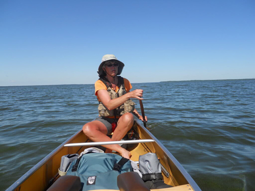
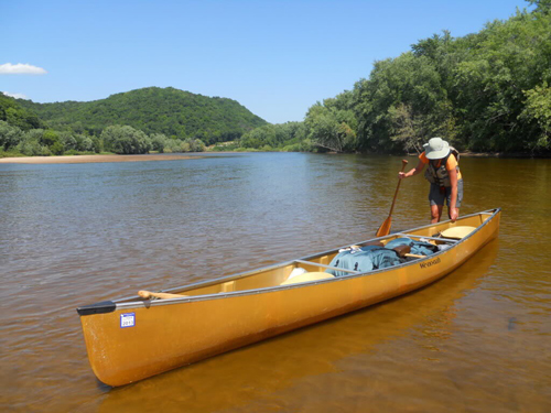
This was the challenge that Mary Kickbush talked her paddling companion Candace Jenkins into undertaking in one summer – to paddle 430 miles from the headwaters on the Michigan border to the shadow of Iowa bluffs across the Mississippi.
Though they’ve shared canoes for twenty years, they call themselves “regular” paddlers who avoid rapids above class 2. This trip would not be a race. Their only deadline was the end of vacation days and return to work. To plan their expedition, Mary and Candace had a tool that Marquette and Joliet couldn’t have dreamed up when they first saw the Wisconsin in 1673: the internet and Wisconsin Valley Improvement Company website (wvic.com). The site includes 23 detailed map segments of the Wisconsin River Canoe Trail complete with campsites and portage instructions. French explorers had the help of Miami tribal guides when they found their portage, but on the water Mary and Candace relied on their trusty gazetteer that never needed a battery charge. They discovered that the Wisconsin is really three rivers: the ox-bowed headwaters, the impounded center, and the free flowing Lower Wisconsin State Riverway.
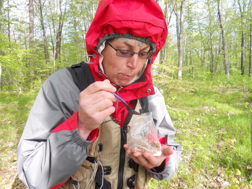
May found them stashing jugs of water under bridges and trying to get some sleep while fishermen nearby stayed up until 4 a.m. Once they launched below the Lac Vieux Desert headwaters they unwound a 70 c.f.s. stream that twisted endlessly through oxbows and alder brush for much of the first 70 miles to Rhinelander. Beaver managed to span the river 16 times, but their dams were not a serious impediment. Straight paddles helped the boat handle tight northern turns before Mary and Candace switched to bent shaft paddles for the open waters of the south. As the days and latitude passed beneath the hull, these travelers witnessed spring budding before their eyes.
The third day brought them to their first significant open-water challenge – the Rainbow Flowage, with buffeting cross winds and a sudden thunderstorm that sent the paddlers to the nearest shore. When their 10-foot tarp was finally stretched to its limit over the 16-foot canoe, they discovered that their shelter from the storm was set amidst a deer carcass on the doorstep of a coyote den. This got them back on the water as soon as lightning passed out of range, but with rain showing no inclination to let up. Stern-paddler Mary tended to hedge her bets toward waiting out the weather, while at the bow, Candace was more inclined to calculate that they might as well face the rain on the water. Rain gear kept them generally dry, although rain does tend to roll down the forearm until it pools in the elbow of a raincoat. This they took in good spirits, fully aware of what to expect from their gear and each other after so many miles of navigation together.
After 190 miles, the pair had passed Mosinee and found the car they had arranged to leave at Eau Pleine County Park. It was time to go back to their real jobs until August, and if not for having employment obligations they would have no reservations about running the entire river in one trip. Instead of being broken down by fatigue, they were actually finding greater strength, and their daily mileage increased as they moved downstream. The logistics of completing the river in two trips actually cost them a couple days. It would have been faster to just run the whole river without all the hassle of driving canoes around on cars. It might seem daunting to paddle a 430-mile river, but when broken down into 18 beautiful day trips minus all the back breaking car shuttles, this is a journey that sounds a lot more inviting. After a week in the Boundary Waters in July, the paddlers were back at Lake Dubay in August to watch the late summer vegetation evolve all the way to the Mississippi.
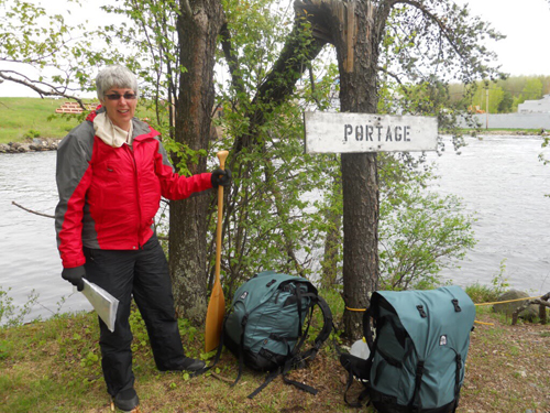
On the whole, the Wisconsin is remote and quiet. Many miles can pass without seeing a soul, but it is by no means beyond the reach of civilization like the Boundary Waters. Of the 18 days spent on the river, hardly one passed without a substantial town with comforts that they might choose to access or bypass unnoticed by the locals. Some of these mill towns were home to substantial urban portages that could see a paddler waiting for a green light with a canoe on their shoulders. Mary and Candace learned to time their arrival for the middle of a weekday at these lengthy portages. Hydroplant owners are required to offer a portage trail and a few offer transportation, but not at all hours, so it takes planning to meet that mill maintenance truck and avoid a mile of city streets.
Our paddlers didn’t mind the 26 dams even though eight came within a 30 mile stretch from Stevens Point to Wisconsin Rapids. The chance to stretch the legs broke up the ten or twelve hours they spent paddling each day. Most portages were short and simple, taking only two trips with gear organized neatly in their portage packs from Granite Gear. These were quick-drying nylon cordura lined with trash bags to keep their contents dry. They learned to always carry a paddle on portages, reasoning that a pirate would be less likely to swipe a canoe without one.
The most challenging day of the trip brought their canoe up against the 16 miles of wide open water on the Petenwell flowage. Paddlers should not expect much help from the current on the majority on the Wisconsin River. Point the canoe where the compass dictates and seek solace in the adrenaline that being far from shore can induce. After six hours of straight paddling, Mary and Candace finally reached the Petenwell Dam and their greatest obstacle. Twenty-mile-per-hour winds formed waves that beat the green algae as thick as house paint and obscured the sharp rocks of their landing site. A wooden platform would have been a preferred take-out, but low August waters made that an impossible hurdle in the wind. A fisherman noticed their predicament and lent a hand so neither paddler was lost in the green murk, nor was the canoe dashed to bits.
Below the Petenwell is where abundant tourists appear on tubes or in duck boats through the “world famous” Wisconsin Dells. Mary and Candace were as surprised as the tourists when a jet boat met them at full throttle around a corner. The attentive captain slowed safely so the incident was nothing more than something to giggle about, later. The Dells were spectacular as advertised with moments of seclusion, and just a few miles below the Dells dam, the populace gave way to quiet undeveloped shore again.
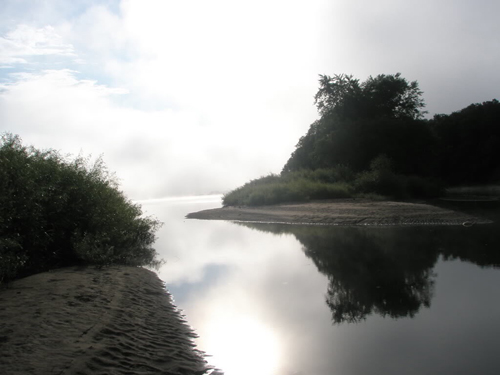
The Wisconsin meets its final dam at Prairie Du Sac, still ninety-two winding miles from the Mississippi. Mary and Candace may not have heard the echoes of the Sauk fording the river while Black Hawk guarded the escape in 1832, but it was clear they had entered the final phase of the journey. The Lower Wisconsin State Riverway is a protected path through serious coulee country, known for abundant eagles and sand bar camping. It was once the stream where the barges of lead miners mingled with lumber rafts, but now it is protected from large scale development and appears lost in time. Following the course of the river as it meandered back and forth around massive sand bars was laborious at times, but finding a beautiful spot to set up camp was no challenge at all.
A nice island site was a good way to avoid the squirrels and raccoons that seemed to hassle the designated sites. Mary and Candace had brought along nine days worth of food including early morning cereal with Nido milk eaten right out of a plastic bag. They got out the stove at night for quick fajitas or tortillas on occasion, and they relished the nights when the bugs didn’t drive them into the tent for dinner. Hikes into town for local ice cream or brew were occasional, and their single night in a hotel may have been more trouble than it was worth. That evening saw them hiding the canoe under brush when it wouldn’t fit through the window or make the corner in the hallway.
On the 18th day, they reached the confluence with the Mississippi below the bluffs of Wyalusing State Park. It had been a little arduous, but not torturous. They had fun, and they proved it could be done. It should be done by any paddler seeking 19th-century travel from town to town by water. Now that Mary and Candace have done it, they may go back and do it again some day, but first they have their baggies packed for the 255-mile St. Croix National Scenic Riverway.